Geospatial Services
The Geospatial Department is a specialized division dedicated to the study, analysis, and application of spatial data to support decision-making processes in various domains.
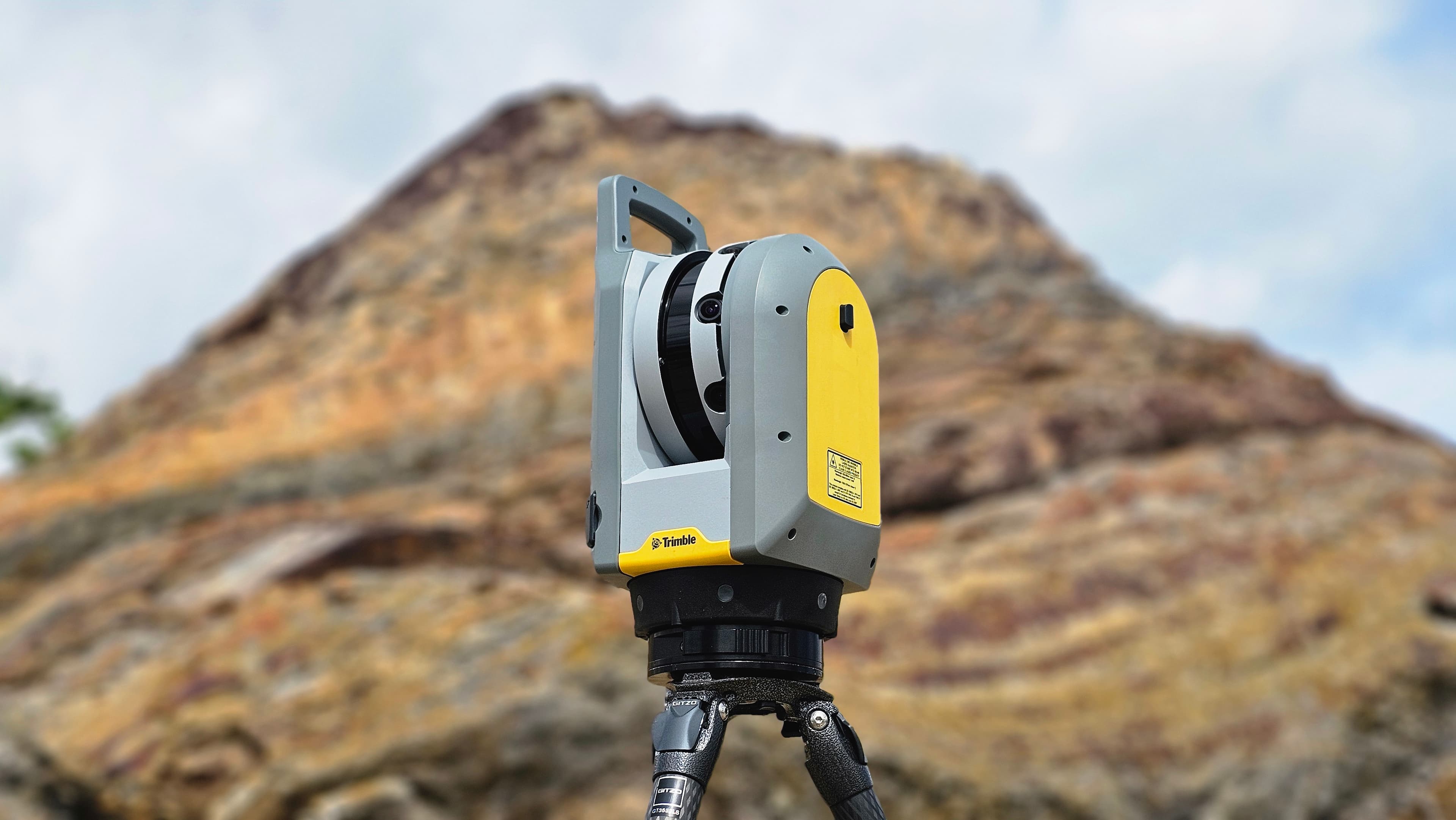
Laser Scanning
Utilizing cutting-edge terrestrial laser scanning and 360 photogrammetry, we create precise 3D models, facilitating thorough site analysis and high-fidelity digital documentation.
Precision 3D Modeling

Asset Inspection
Leveraging advanced terrestrial laser scanning and 360-degree photogrammetry, we deliver detailed 3D models for comprehensive asset inspections, ensuring accurate site analysis and reliable digital documentation.
Comprehensive Asset Analysis
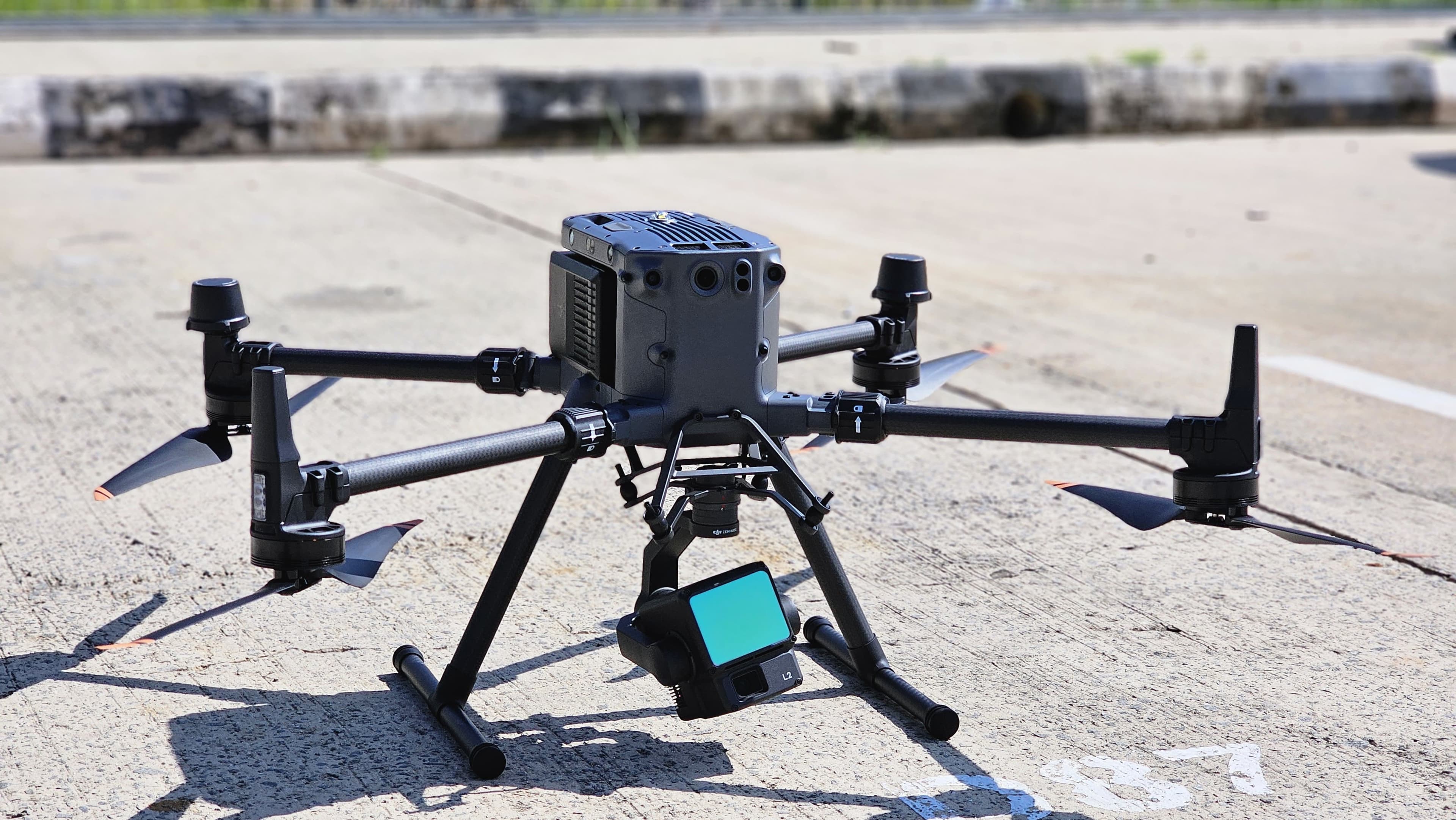
LiDAR Survey
Equipped with a LiDAR scanner, our drones can effortlessly survey diverse terrains, generating accurate 3D maps perfect for applications in forestry, mining, construction, archaeology, and infrastructure.
Advanced Terrain Mapping
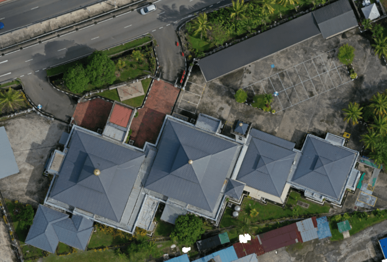
Orthophoto Processing
We produce high-resolution orthophotos, ensuring accurate and distortion-free aerial imagery for precise geospatial applications.
Accurate Aerial Imagery
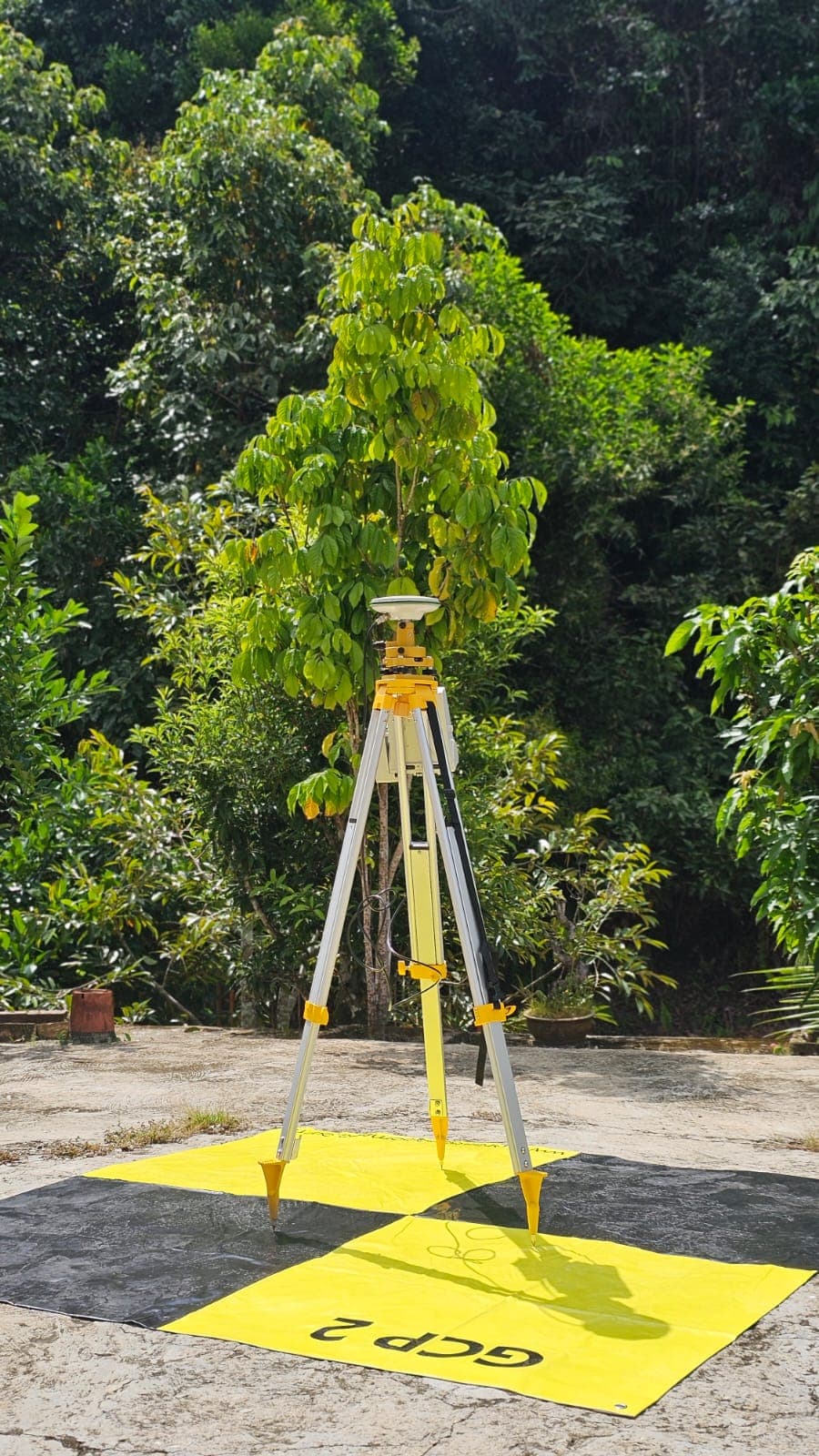
Global Navigation Satellite System (GNSS)
Leveraging GNSS technology, we offer high-precision geospatial positioning, enabling accurate data acquisition for complex mapping and surveying projects.
High-Precision Geospatial Solutions
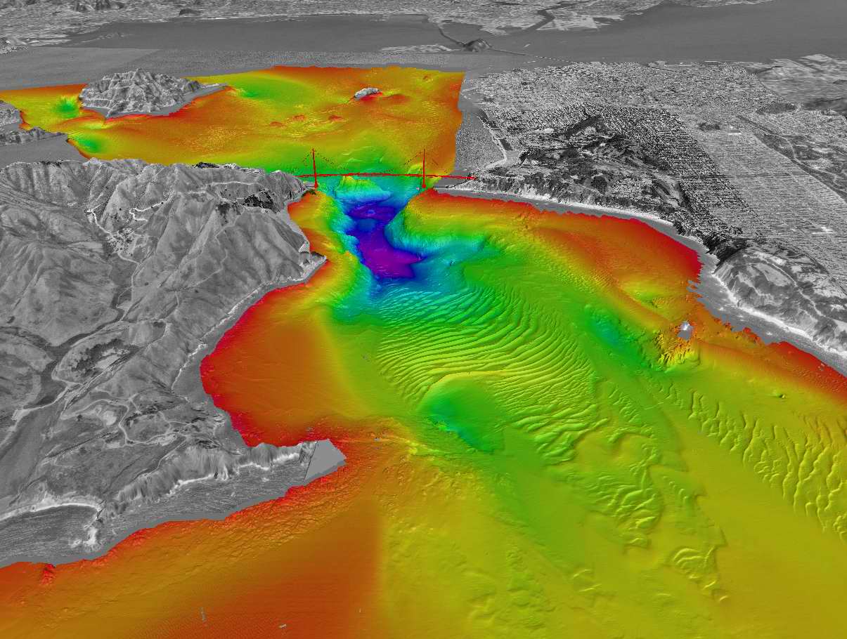
Seabed Topography
Our seabed topography services offer detailed marine mapping, essential for understanding underwater terrains and supporting coastal and offshore projects.
Marine Terrain Analysis