Geoscience Services
Geoscience is the study of the Earth, its structure, processes, and materials. We offer a wide range of services, from geological surveys to educational outreach, all aimed at understanding and protecting our planet.
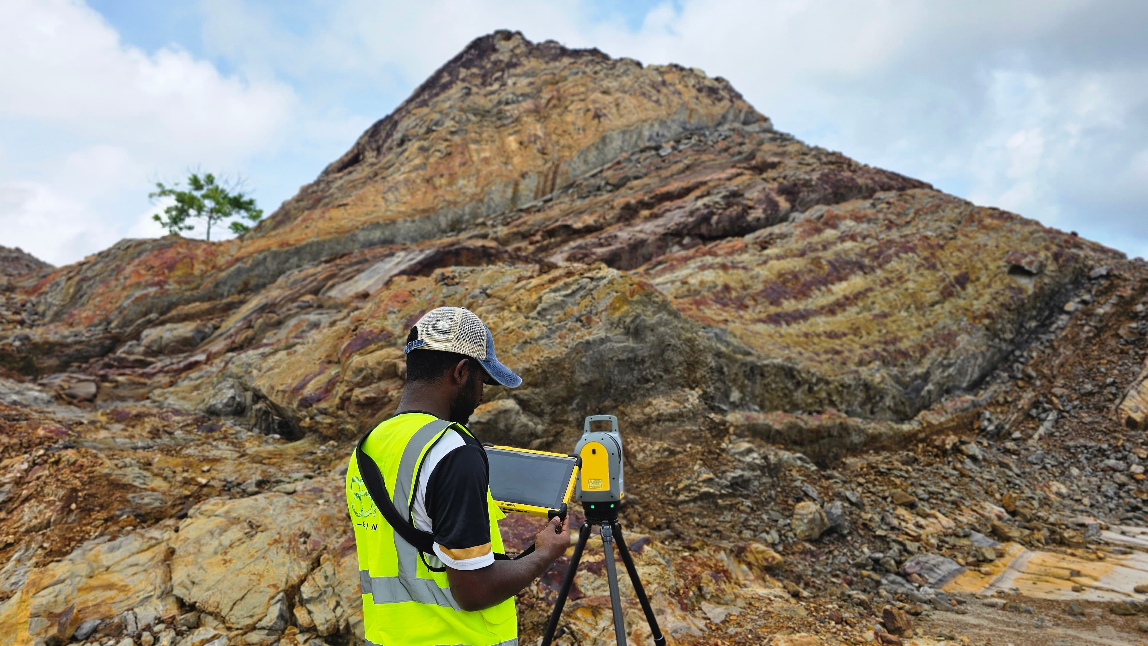
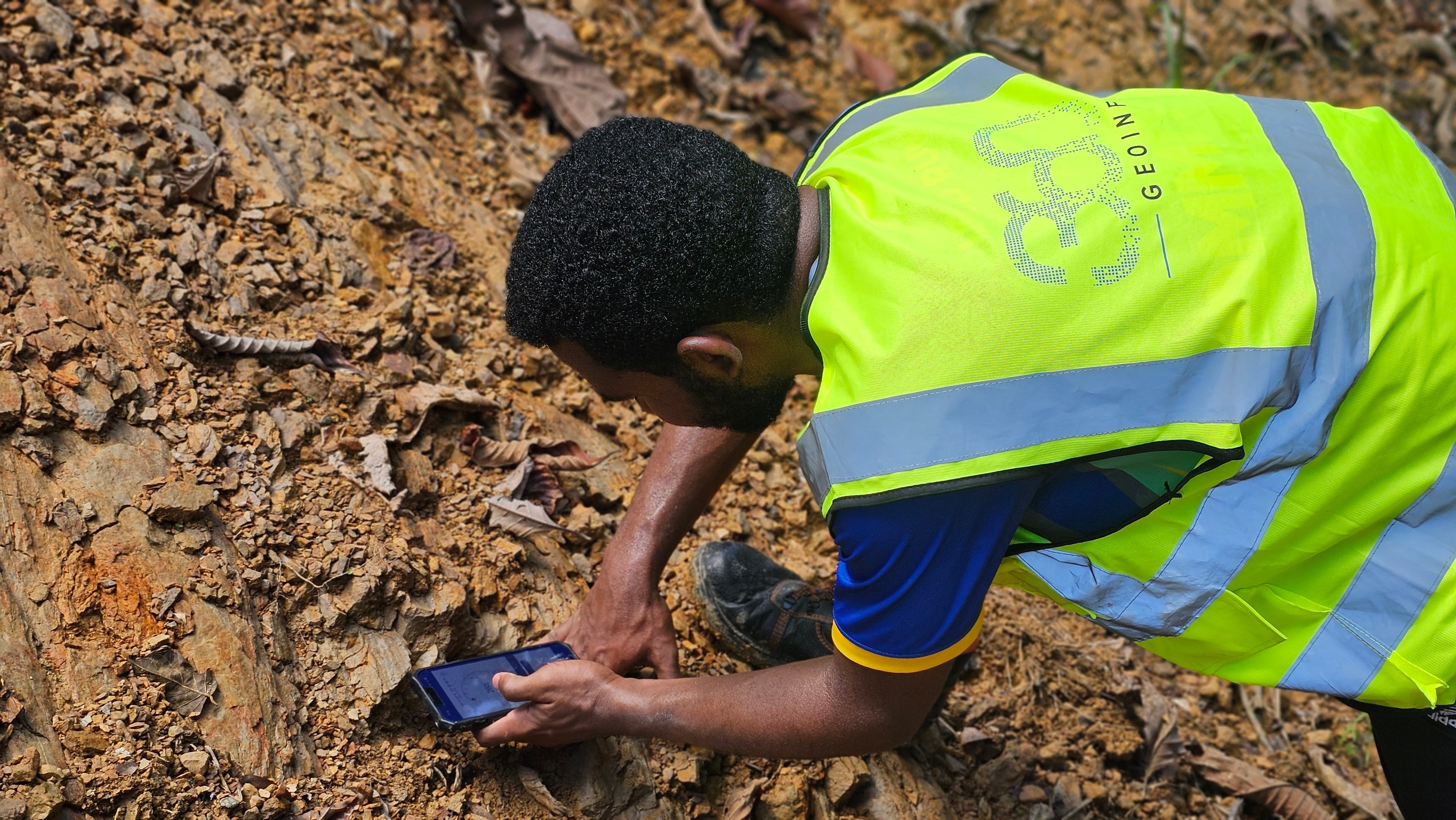
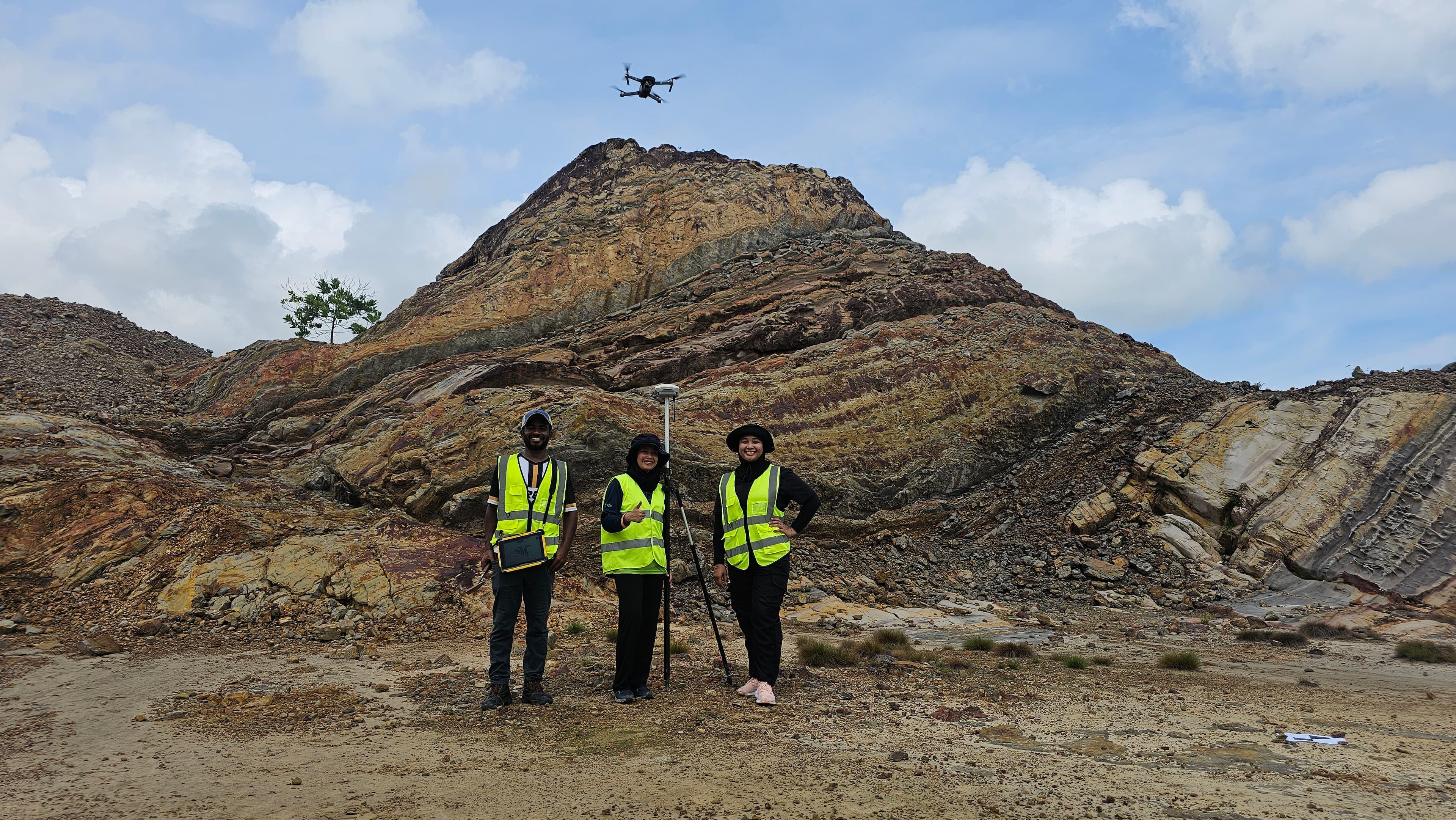
Geological Surveys and Mapping
We specialize in conducting detailed geological surveys and mapping, utilizing advanced softwares to analyze subsurface geology, stratigraphy, and structural features for applications in resource exploration and land-use planning.
Geological Mapping Specialists

Underground and Utility Detection Survey
Employing advanced geophysical techniques, our surveys accurately identify and map subsurface utilities, mitigating risks and supporting informed infrastructure development.
Subsurface Detection Experts
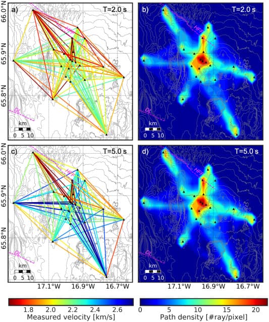
Geophysical Survey
Employing techniques such as seismic reflection, electromagnetic, and gravimetric surveys, and utilizing specialized softwares, we provide in-depth analysis of subsurface properties for resource identification, geotechnical investigations, and environmental assessments.
Geophysical Survey Specialists
Natural Hazard Analysis
Our natural hazard analysis integrates GIS-based modeling and probabilistic assessment methods to evaluate risks from seismic events, floods, landslides, and other hazards, supporting disaster risk reduction and resilient infrastructure design.
Natural Hazard Analysis Experts
Seismic Noise Monitoring
Using state-of-the-art seismic sensors, we provide real-time noise monitoring to deliver precise data on subsurface activity, enhancing site safety and project planning.
Seismic Risk Analysts

Educational Outreach and Public Engagement
Our educational outreach programs are designed to enhance public understanding of geoscience through interactive GIS platforms, workshops, and digital resources, fostering informed community involvement in environmental and resource management.
Geoscience Educators

Consulting and Advisory Services
We offer expert consulting and advisory services, drawing on our deep expertise in geoscience and utilizing industry-standard software to deliver tailored solutions in areas such as resource exploration, environmental impact assessment, and geotechnical engineering.
Consulting and Advisory Services